Northern California-based ocean drone operator Saildrone has reached a partnership with Austal USA for designed to meet the growing demand for Saildrone’s uncrewed surface vehicles, known as Saildrones.
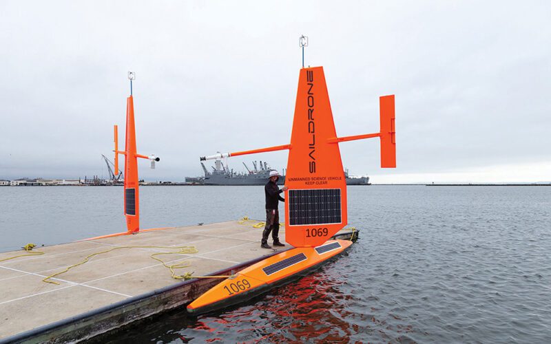
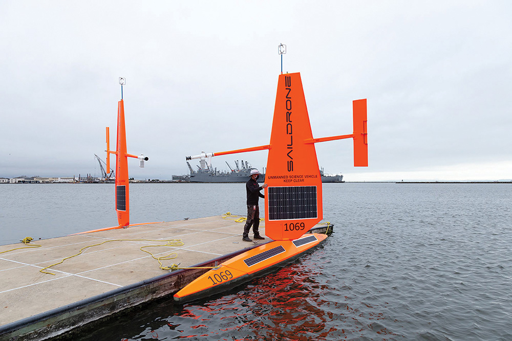
The 65-foot Saildrone Surveyor is designed for deep ocean mapping and intelligence, surveillance, and reconnaissance applications, above and below the surface. The Surveyor, which was developed and designed by Saildrone, will be manufactured exclusively by Austal USA in Mobile, Alabama.
The new partnership, which was revealed by the companies at the end of August, provides the U.S. Navy and other government customers a solution for maritime domain awareness, hydrographic survey and other missions requiring persistent wide area coverage.
Austal is expected to begin manufacturing Saildrone Surveyors for the Navy in October.
“We are extremely pleased to enter into this agreement with Saildrone,” Austal USA President Rusty Murdaugh said. “It is a great fit as both of us are leaders in our respective markets and we both strive to provide leading-edge solutions to the U.S. Navy.”
Autonomous vessel capability has been identified as an area of strategic importance by the Navy. Saildrone’s vehicles, powered by renewable energy, will be built alongside the continued development of the Navy’s Overlord vessels.
“Saildrone is the clear world leader in small uncrewed systems, with a track record of almost one million ocean miles under our belt on our 100-strong fleet,” Saildrone founder and CEO Richard Jenkins commented. “Austal is leading the way in the large uncrewed sector, pioneering autonomy and reliability of much larger systems capable of carrying much heavier payloads. We see these two technologies as extremely complementary.”
“Building these two extremes of size in the same facility, and leveraging Austal’s advanced manufacturing capabilities, will dramatically accelerate our ability to get Saildrones into the hands of our customers,” Jenkins explained.
As with all Saildrone vehicles, the Surveyor is autonomous, uncrewed and has been optimized for maritime security and ocean mapping missions, according to Saildrone. It provides ocean mapping down to 23,000 feet (7,000 meters).
Ocean mapping is typically done by survey ships, which can be expensive, difficult to book, and powered by fossil fuels. Operating without crew, the Saildrone Surveyor can operate continuously for up to 180 days, according to Saildrone, while delivering information faster and at a fraction of the cost and carbon footprint of traditional survey ships.
Saildrone’s proprietary machine learning model, which can automatically recognize and classify objects in real time, was trained on Saildrone’s unique data suite of labeled maritime images, containing millions of images captured during missions over the past seven years, according to the company.
The first Surveyor was built by Saildrone in Alameda, Calif. and launched in January 2021. That vehicle is currently mapping areas of the Aleutian Islands, as part of an intra-agency effort facilitated and led by the NOAA Ocean Exploration Cooperative Institute.