of Saildrone.
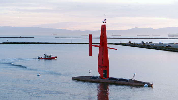
As data from the Saildrone Surveyor was still being mapped after her maiden voyage from San Francisco to Honolulu, owners of the uncrewed, autonomous vessel powered primarily by renewable wind and solar energy were already planning a fleet of Surveyors to map the world.
“This successful maiden voyage marks a revolution in our ability to understand our planet,” said Richard Jenkins, Saildrone founder and chief executive officer. “We have solved the challenge of reliable long-range, large-payload remote maritime operations. Offshore survey can now be accomplished without a large ship and crew.”
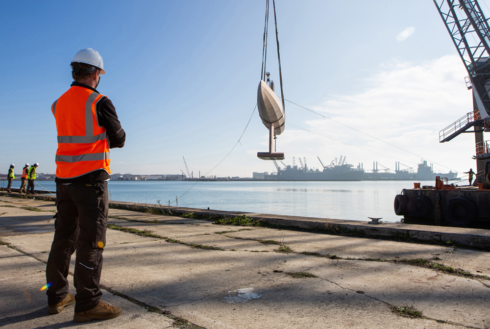
The 72-foot long, 14-ton Surveyor arrived in Honolulu on July 8, after a 28-day voyage of 2,250 nautical miles and mapping of 6,400 square nautical miles of seafloor. The vessel, billed as the only vehicle in the world capable of long-endurance, uncrewed ocean mapping operations, will be the first of a new fleet which Jenkins predicts will map Earth’s oceans with the next 10 years.
Jenkins said that based on Surveyor’s achievement, he is now excited to apply Surveyor technology to other markets normally reserved for large ships, such as homeland security and defense applications.
“The implications of a low-carbon solution to these critical maritime missions are significant,” he said.
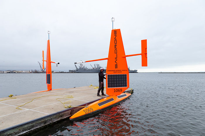
Given the successful proof of concept voyage, Saildrone Inc. headquartered in Alameda, California, will now build a fleet of Surveyors to be manufactured at U.S. shipyards, Jenkins said. The company intends to map all the Earth’s oceans in the next 10 years.
Oceans cover over 70% of the planet, yet over 80% remains unmapped and unexplored, Saildrone officials say. That lack of ocean exploration is largely due to the high cost of ocean access, which has traditionally been done using large ships, which cost hundreds of millions of dollars to obtain, and hundreds of thousands of dollars a day to operate.
From Honolulu, Surveyor embarked on a short survey off the coast of Oahu to gain a better understanding of how well the systems perform compared to a traditional research vessel, said Brian Connon, Saildrone’s vice president of ocean mapping. Then Surveyor set sail back to California, mapping gaps along the way, to continue to tune all of the sonar systems in preparation for upcoming missions.
Connon said it takes about one day for every two days of survey to process the data for analysis, depending on the quality.
“On a 28-day survey, it will take roughly two weeks of dedicated time to ‘clean’ the data,” Connon said. “If there are spurious soundings, sound velocity artifacts, tide corrections required, for example, that adds to the processing time. It is an estimation, not a rule,” he explained.
While the specific variety of information being sought in ocean mapping depends on the mission, “generally speaking we are looking to characterize the sea floor,” Connon said. “How deep is it? What features exist? What kind of substrate (hard or soft)?”
All these factors help us determine what types if resources or ecosystems might be present in a given area for further exploration and discovery, he explained.
“These mapping data will provide the scientific community with the information they need to effectively and strategically plan future operations for sensor and vehicle sampling missions,” Connon said.
The amount of detail ocean mapping provides depends on the depth of the sea floor and the frequency of the sonar.
“If we are surveying a shallow area with a high frequency sonar, we can resolve very small objects such as sunken vessels, discarded anchors, pipeline and more,” he said. “If we are surveying in deeper waters, we need to use a lower frequency sonar for the sound to travel far enough to reach the bottom and return the signal. The deeper you survey, the more difficult it becomes to identify small objects.”
That was why it was so difficult to find the remains of the Malaysia Airlines Flight 370 passenger plane that disappeared in March of 2014 while flying from Kuala Lumpur to Beijing. It was too deep for a surface vessel to detect, so a sonar had to be brought closer to the sea floor on an autonomous underwater vehicle with a higher frequency sonar to have the ability to resolve an object the size of the plane, Connon said, adding that this makes the survey area much smaller and more time consuming.
The multibeam sonar is not designed to identify specific critters, but the Simrad EK80 fisheries sonar on board Surveyor can identify biomass in the water column such as fish and plankton,” he explained. “Multibeam sonar can be used to identify habitats, areas where coral will live for example—not critters specifically.”
For now, the number one priority is mapping the U.S. exclusive economic zone as soon as possible, since 50% of U.S. territory is underwater, Connon said.
“The other areas we will map depend on the funding source and the mission goals,” he explained. “Other countries have a similar requirement to map their EEZ, and we are in active conversation with several.”
The development of the vehicle has been a true partnership, Saildrone officials said. In 2019, NOAA provided a three-year grant through the National Oceanographic Partnership Program to the University of New Hampshire, in partnership with the Monterey Bay Aquarium Research Institute and Saildrone, to integrate and test sensors on the Saildrone Surveyor for mapping the seafloor and revealing life in the water column.