
No doubt older mariners remember the LORAN navigation system, but for those too young to use LORAN, it may not be long before you must learn.
For the uninitiated, if you’ve ever wondered what those gridded lines on navigation charts are, you might be interested to hear about the navigational aid. The LORAN system was developed during World War II and used to accurately position mariners for about 60 years until it was declared obsolete and decommissioned in 2010.
Its successor, GPS (Global Positioning System), is so powerful and easy to use that it has become a part of our everyday lives, in our cars, phones, computers and even watches. However, while GPS is incredibly convenient, it unfortunately can be manipulated by “jamming” or “scrambling” the signal — tactics that enemy forces could use to misdirect and confuse mariners.
While LORAN was never as user-friendly as GPS, it transmits a much stronger signal that can be reliably received without disruption. Now more than ever, we need to consider bringing back the LORAN system as an additional navaid to safely navigate U.S. mariners through foreign waters.
A Brief History
Long Range Navigation, or simply LORAN, began development in 1940 as America’s involvement in World War II seemed imminent. U.S. scientists recognized the need for a navigation and positioning tool—especially while in enemy territory. So, they began creating a system that originally worked on the same spectrum as Very High Frequency (VHF) radio. Eventually, LORAN or (LORAN-A as it’s now known) was completed and operated on a lower Medium Frequency (MF) band with fairly accurate position fixes up to just a few hundred feet away.
This long-distance accuracy proved to be crucial in the Pacific Ocean theater, including places where mariners and pilots would be too far offshore for radar or visual bearings, and traveling through weather that wouldn’t always allow for celestial navigation.
How Does LORAN Work?
The technical details behind how LORAN systems work are too extensive to cover in-depth here, however it can be understood by picturing a group of transmission stations or towers that are setup all along the coasts. These stations send out radio waves that mariners can create lines of position from based on the different times they received the signals.
In all navigating scenarios, there’s two types of dedicated LORAN stations: “master” and “slave” stations. A ship’s navigator could pick up a radio signal transmitted nearly simultaneously by both types of station. Judging by the time difference between the two signals, the navigator would be able to create a line of position. If they do that same process a second time, with the same master station, but now a different slave station, they’ll be able to plot a second line of position. The point where the two lines of position intersect serves as a fix for the location of the vessel.
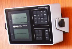
After its success in World War II, LORAN-A experienced a failed redesign called LORAN-B and in 1957, engineers eventually refined the system with LORAN-C, which is the system mariners are most familiar with and seriously improved the range and accuracy. LORAN-C ruled up until the introduction of GPS to the public in the 1990s.
Phased Out For GPS
Global Positioning Systems had been in development since the 1970s, but weren’t released to the general public until the mid ‘90s. Since that time, GPS has integrated itself into almost all technology we use daily. GPS uses trilateration (not to be confused with triangulation), which takes ranges from your device’s receiver, whether it be your phone or computer, to the known position of a satellite in space. Where these ranges from multiple satellites intersect is your location.
GPS became as popular as it is today because it’s easy to operate and maintain, and is exceptionally easy for people to use because it’s so well integrated into our technology. LORAN-C required professional training and skill to operate correctly and even then, it was still subject to human error.
GPS quickly became adopted as the superior system because just about anyone could reliably use it. While many vessels quickly switched over to GPS, interestingly some fishing vessels were known still to rely on LORAN-C for its repeatability, well past the advent of GPS.
After a few years of crossover, the U.S. Coast Guard began shutting down the LORAN-C transmitting station and by 2009, the last LORAN-C stations were shut down by President Obama, ultimately as a budget cut during the Great Recession.
Enter eLORAN
Even in the twilight years of LORAN-C, the Department of Defense and many others in the navigation and positioning field have recognized the shortcomings of GPS. In 2004, the U.S. and British governments collaborated to create eLORAN, an updated, hyper accurate and much more user-friendly version of LORAN.
While the general principle of how both systems work is the same, there are a few noticeable upgrades between LORAN-C and eLORAN, starting with the hardware. eLORAN uses solid state transmitters instead of the older, more expensive and prone-to-failure vacuum tube transmitters.
Also, eLORAN sends digital, not analog, signals that can be encrypted, with built-in differential corrections that are calculated by the eLORAN receiver unit and applied back to the signal, ensuring you’re getting an accurate position. Additionally, eLORAN’s digital signals are also synchronized to Universal Coordinated Time (UTC) so it’s easier to read, and the transmitters have a built-in antenna, so you don’t have to install or maintain any external receivers.
But while eLORAN is updated for modern times, the basic functions of the older system remain. The system relies on a series of shore-based transmitters that form the lattices (grids) for mariners to navigate from. There’s “master” transmission stations and many more slave stations to derive fixes from.
eLORAN Needed Now More than Ever
For all its convenience and popularity, GPS actually has more vulnerabilities than the average citizen might guess. GPS signals are relatively weak and can be subject to jamming or spoofing, which are tactical methods to distort or block the incoming signal. GPS and other satellite-based systems operate in the HF (high frequency) radio band using low power levels. This allows the signals to cover great distances, but at the cost of being easier to interfere with.
In times of war or economic competition, enemy nations could use these tactics to hinder navigation or miss-navigate U.S. vessels. Obviously, mariners are well trained to navigate via chart plotting and celestial navigation, but there are still times when the weather and conditions make it difficult and getting an accurate fix is critical.
GPS and all Global Navigation Satellite Systems (GNSS) like it, are space-based, meaning they rely on fully functioning satellites to work correctly. This leaves GPS vulnerable to both intentional and accidental attacks, as satellites can easily become damaged or destroyed.
As of 2020, the U.S., China, Russia and India have all intentionally shot down their own GNSS satellites to test the capability of doing so. These targeted attacks demonstrate the ability to wage an accurate assault on enemy satellites if need be.
Aside from these potential strategic attacks on satellites, there’s also the unplanned and completely accidental collisions satellites face as an ever-increasing amount of space trash (floating debris) is in orbit. These are rare, but they are happening with an increasing frequency as more and more satellites are launched into orbit every year. So, while GPS is space-based, eLORAN is ground-based on earth, and transmission stations can be set up and maintained much easier than satellites.
To hear how desperately we need eLORAN as a GPS backup, can look no further than Brad Parkinson, the man known as the “father of GPS.” Parkinson, an engineer and inventor who was GPS’ lead architect and developer, has said that he recognizes that GPS poses a national security risk.
“Reliance on satellite navigation and timing systems has become a single point of failure for much of America, and it is our largest, unaddressed critical infrastructure problem,” he was quoted as saying in 2013. Not only does he believe that GPS can be manipulated, but he also believes eLORAN, specifically, can offset GPS issues.
“I subscribe to PTA; Protect, Toughen and Augment this valuable asset. Particularly appealing is the use of eLORAN to augment … in this role, eLORAN would be a powerful deterrent to malicious interference,” he said in a 2013 speech at Stanford University.
Parkinson is considered the key engineer behind GPS and someone who knows its inherent failure points better than anyone else. If he, of all people, is supporting eLORAN, it raises the question: what does eLORAN have that GPS doesn’t?
GPS’s Weaknesses are eLORAN’s Strengths
The reason some believe LORAN remains our best supplemental navigation aid is because it doesn’t share any common failures with GPS. All of GPS’s weaknesses are eLORAN’s strengths and vice versa. The two complement each other well and cover each other’s shortcomings. GPS is space based, eLORAN is ground based. GPS has a low-powered signal at a high frequency, whereas eLORAN is a high-powered signal at a low frequency.
What this means is that eLORAN’s signal is about 3–5 million times stronger than that of GPS, but it can’t travel as far. GPS signals can travel 12,000 miles to space and back, but they lack strength, especially in dense environments. eLORAN’s signal is so strong it can penetrate buildings, dense jungles and even reach underwater, something that GPS simply can’t do.
Additionally, since eLORAN is land-based, it’s relatively inexpensive to operate and maintain the stations once the necessary infrastructure is installed. Another advantage of being ground based is accessibility. Engineers can drive to an eLORAN station or create one covertly here on Earth. Space presents its own unique challenges and vulnerabilities.
Finally, one of the largest and most dangerous flaws of GPS is it can be “spoofed” or manipulated. While there are other methods for mariners to determine their position, a series of uncaught “spoofed” fixes could potentially be used by enemy forces to confuse, miss-position and potentially damage a vessel.
Fortunately, eLORAN can authenticate transmissions, and send transmissions encrypted, both of which prevents spoofing.
Where Does the Government Stand?
The U.S. Government has long been aware of GPS’s shortcomings, and in recent years various government branches have pushed for a re-appraisal of eLORAN.
As early as 2008, during the end of the Bush Administration, a press release was issued reporting the development of eLORAN as a supplemental navaid. Unfortunately, the recession hit, and nothing materialized until LORAN-C, and LORAN in general, were decommissioned in 2009.
However, discussions of eLORAN didn’t cease, and it was only a few years later when President Obama switched back to support LORAN, signing the Coast Guard Authorization Act of 2015 near the end of his presidency. The Act advocated for working with public and private entities to develop, “a positioning, navigation and timing system to provide redundant capability in the event Global Positioning System signals are disrupted, which may consist of an enhanced LORAN system.”
More recently, President Trump signed the National Timing Resilience and Security Act of 2018, which called on the Department of Transportation to reduce our critical dependency on GPS, propose an implementation plan to make America less dependent on GPS within the next two years and discuss creating possible eLORAN facilities.
Sadly, as of now, there’s still no news as to the development or completion of this plan.
What Does eLORAN Need?
For eLORAN installations, full coastal coverage would be needed in order to have the best distance spread possible. This would require 25 new stations—six master stations for timing and 19 slave stations that lock in the position for navigation.
What eLORAN needs most though is funding, plain and simple. The Department of Transportation is responsible for the development of eLORAN and was charged by Congress via Trump’s 2018 act with doing so. However, as of May 2022, at least publicly, no funding for eLORAN has been issued by Congress. It seems insane, but at least we’re further along than other countries, right?
Unfortunately, that’s not the case.
Russia, China, South Korea and Saudi Arabia never shut down LORAN-C, and all those countries, as well as Iran, have actively been developing their own eLORAN systems. On top of that, Russia is actively using its version of eLORAN in the current conflict with Ukraine, most likely under the assumption that they might lose GPS at some point.
If Russia recognizes how easily the major world powers could destroy each other’s GPS satellites, surely, the U.S. can’t count on them to spare ours.
ELORAN Needs Support
Overall, eLORAN is a proven system that covers all the failure points of GPS and would be easy to implement if properly funded. Again, eLORAN isn’t expected to replace GPS, but to serve as a supplemental aid to GPS.
A huge portion of our economy and our careers depend on ships being able to navigate properly. We as mariners need to do what we can to support the funding and implementation of eLORAN not only for national security, but job security as well.
Stefan Endres is a sophomore cadet at California Maritime Academy, where he’s studying Marine Transportation. He was introduced to the topic of LORAN while working on a navigation problem, noticing the pink LORAN-C lines still printed on training charts today.