The U.S. Coast Guard’s first comprehensive review of vessel traffic patterns off the California, Oregon and Washington coasts has been published, the agency announced June 7.
The Guard put out in the Federal Register the final report of the Pacific Coast Port Access Route Study (PAC-PARS), which aims to determine historic and future waterway use to see if there is navigational risk and offer recommendations to maintain safe navigation.
To accomplish this work, the study looked at vessel tracking data from the last decade as well as various datasets, including environmental data, current and planned offshore development infrastructure, and past marine incident data, according to the agency.
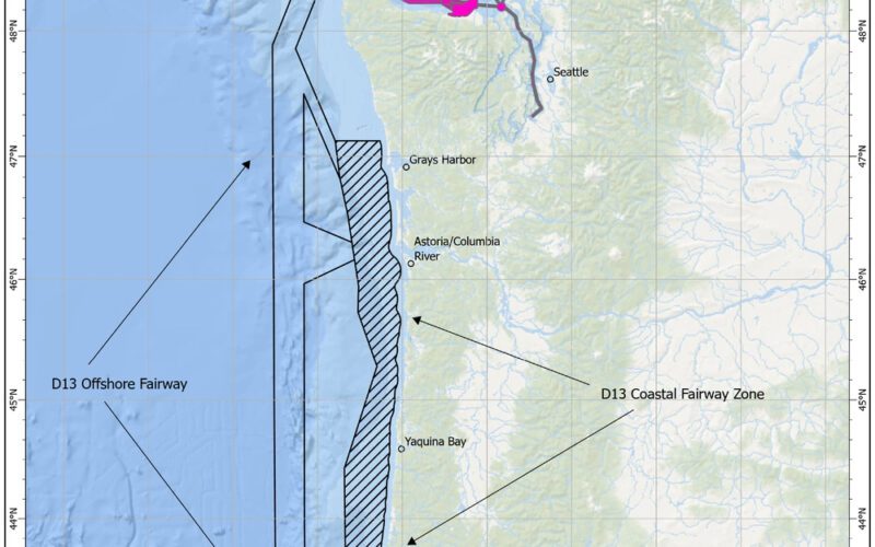
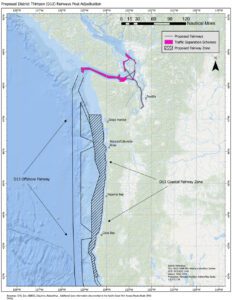
The study recommends that new voluntary fairways be established for coastwise and nearshore vessel traffic with links to current Traffic Separation Schemes and ports, allowing for “safe and predictable traffic patterns” as more people use Pacific coastal waters, according to USCG.
“The variety and number of waterway users along the Pacific Coast has dramatically increased over the past decade; in the interest of maintaining navigational safety for all members of the maritime community, the Coast Guard conducted this study,” Coast Guard Pacific Area port and waterways specialist, Lieutenant Liesl Olson explained. “It’s fairway recommendations promote safe vessel transits along the coast and connect to major port approaches.”
The study can be found at https://www.navcen.uscg.gov/port-access-route-study-reports.